

 Riecker Chiropractic


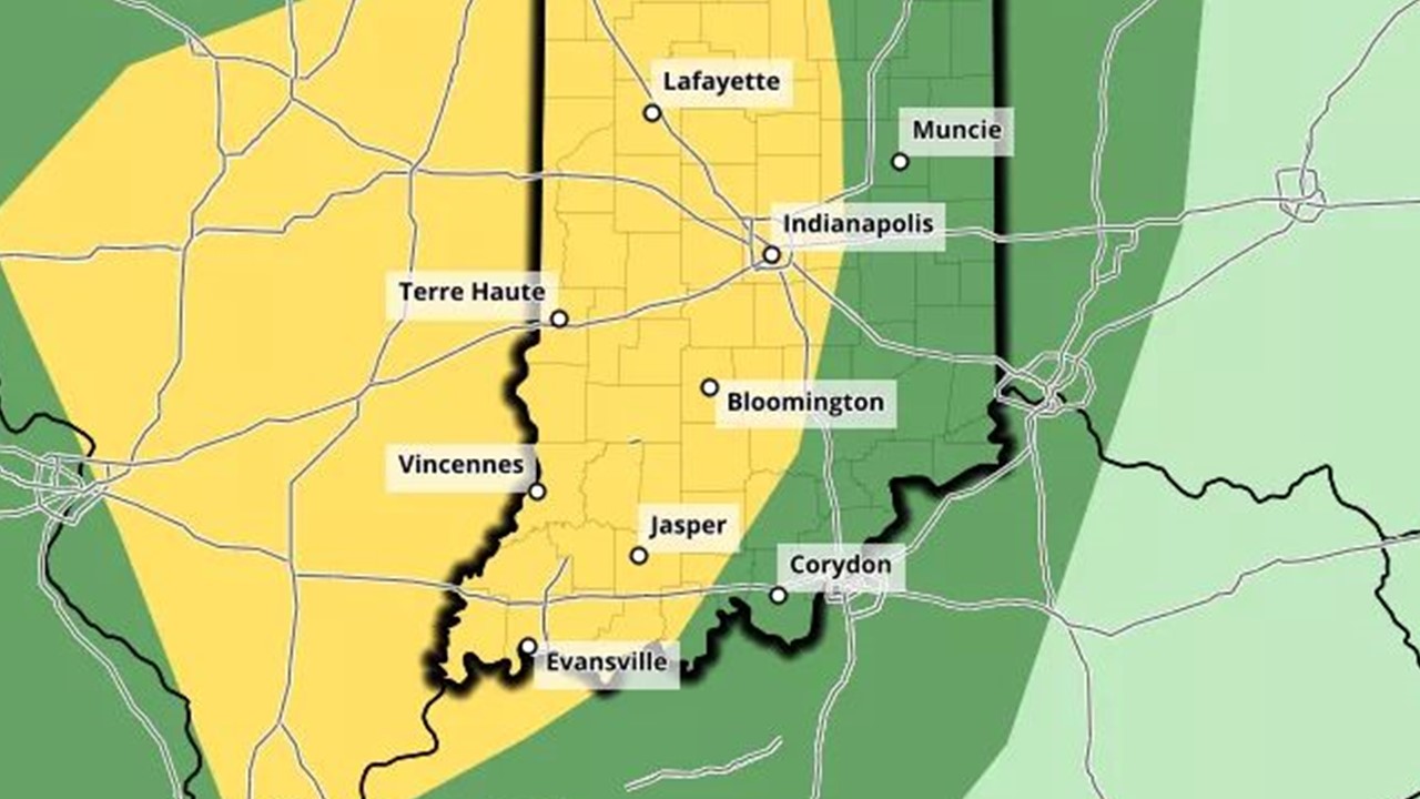
Dubois County is Under a Tornado Risk Tuesday as Tropical Remnants Move West of the Area
BY: DAVID SHEPHERD, NEWS DIRECTOR / FORECASTER
COUNTY WIDE -- The Storm Prediction Center has placed the entire area under a risk for severe weather today, this, as the remnants of tropical storm Cristobal move just to our west.
"Basically anywhere from noon until 10 pm would be our most likely threat. We're going to be keeping a close eye on things during the afternoon and evening hours Tuesday," says Joe Nield, a meteorologist with the National Weather Service in Indianapolis.
Nield says every part of Indiana needs to be ready.
"Pretty much all of central Indiana will be affected. The western half of Indiana will be in the highest threat area, but eastern Indiana is still going to have a threat as well. You're going to want to have your plan in place to take action in case a warning is issued on Tuesday," says Nield.
Forecasters warn, since this is a tropical system, we need to keep our eyes out for tornadoes to form.
If you are in a mobile home or other particularly vulnerable location, meteorologists suggest you seek shelter in a more secure spot well before storms actually approach. Waiting for a tornado warning to be issued may not give you enough time to escape.
Remember, the tornado siren in the Town of Holland is not working. Be sure you have fresh batteries in your weather radio and stay tuned to WITZ on-air and on Facebook for the latest information through the day.