

 Riecker Chiropractic


BREAKING NEWS: Patoka Lake Reservoir Nearing Spillway Release
From Local Sources
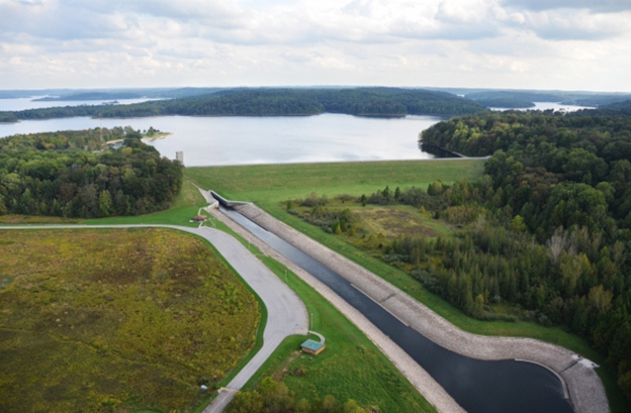
AREA WIDE -- Due to heavy rains over the past several months, Patoka Lake, near Dubois, IN has been at an extended elevated stage. Efforts to lower the lake level have been hampered by continued rainfall. This is a very similar situation as reported in early May, the last time the lake was at this very high pool level.Precipitation overnight exceeded the forecasted amounts and has used most of the flood storage in the reservoir. With current rainfall forecasts, the lake is projected to reach the spillway elevation on the morning of Tuesday, June 18, 2019. As of 1 p.m. today, the lake level is 547.4 feet, or 94 percent full. This elevation is very near the spillway crest elevation of 548.0 feet. The spillway is a non-gated open rock cut located away from the dam and is designed to allow a safe release of excess water. The top of the dam is elevation 564.0 which is safely 16 feet above the spillway floor elevation.
The potential for water to flow through the spillway will exist from Tuesday, June 18 into the following week. With current forecasts, the amount of water to be released through the spillway is anticipated to be minor. Per the project's water control plan, the U.S. Army Corps of Engineers has reduced flows from the reservoir down to the minimum 20 cubic feet per second to minimize flood damages downstream. As soon as river flows below the project recede, we will increase releases through the dam's gated outlet works to begin lowering the lake level.
USACE staff have been performing increased surveillance and monitoring of the dam to ensure its safety. No concerns of the integrity of the dam have been observed and it is structurally sound and operating as designed. The lake is currently storing water and providing flood damage reduction.
If spillway flow occurs due to an additional heavy rainfall event, residents in Dubois and Jasper, Ind., (and other areas downstream such as Winslow and Patoka) would experience higher river stages than they would with a similar rain event. This is due to the fact that the project has reached its maximum amount of flood storage. River levels are highly dependent on the amount of uncontrolled runoff downstream of Patoka Lake Dam in combination with releases from the project.
If you reside or own property along low lying areas adjacent to the Patoka River please keep aware of weather forecasts and associated river levels that could impact you. Areas around the lake shoreline may also be impacted because of the increased level of the lake.
The Corps is working with local and state emergency operation managers in efforts to keep people affected by this situation safe and informed. This is a collaborative effort.
To monitor real-time lake and river level information, please visit the USGS web site at: https://waterdata.usgs.gov/in/nwis/current/?type=flow
Patoka Lake Gauge: https://waterdata.usgs.gov/in/nwis/uv/?site_no=03374498&PARAmeter_cd=00065,00060,62614,00010
For the latest updates visit: www.facebook.com/LouisvilleUSACE